
The weather on Curacao
For the weather on Curacao are going at it again.. the hurricane- ánd rain seasons have announced themselves.
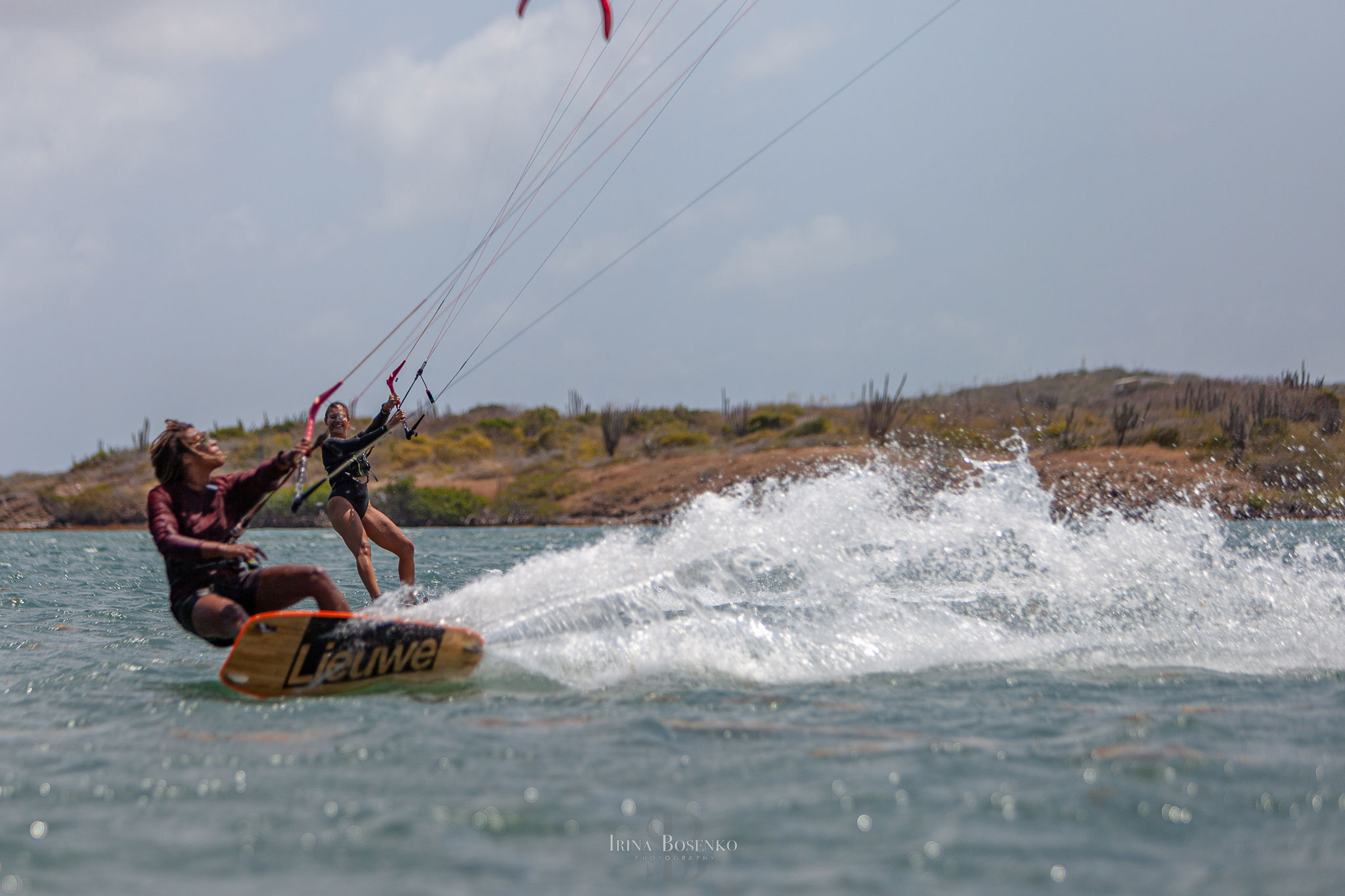
For a couple of days already there isn’t a single breeze to be felt and the nights are filled with this beautiful sound of rain on our roofs. But its been long overdue. After days of visualising tricks and analysing my lesson methods it it finally seems to be happening.. there will be a breeze. With my high volume directional and lovely wave kite I enter the water. I’m all by myself.
All of the sudden the air cools down and everything darkens a bit. I look behind me and see some rainclouds coming my way and smile.
With rain comes wind… and… a rainbow!! I look at the point of my directional and see the beginning of the bow starting right at my surfboard. Wauw! No pot with gold but a blissful feeling.
The weather on Curacao is giving me a beautiful gift, but how does the weather actually come about?
How the weather on Curacao works?
The weather on Curacao is actually nothing more then the state that the atmosphere is in and how it’s behaving. It can be warm or cold, it can move around, accumulations of water vapor can float around and there can be atmospheric accumulations/ thinning out, or in other words high or low atmospheric pressure.
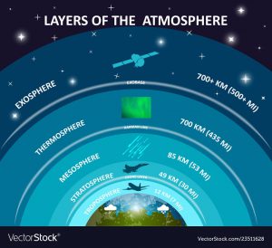
The atmosphere closest to earth or the stratosphere is the most sensitive for weather phenomena’s.
Meteorological phenomenons are observable events surrounding the weather and are expressed in variables of the earths atmosphere: temperature, air pressure, water vapor and mass flow.
With regards to the weather on Curacao, we almost always have the constant Trade wind, except in the hurricane season or during the rain season when weather systems disturb our usual airflow patterns. The Trade winds are also less powerful and consistent during the period of sept-dec.
Whom we have all this to thank to? The warmth of the sun!
Trade winds
The weather on Curacao is possible due to it’s location. Due to the surface consisting out of water and land the rotating earth does not heat evenly. This uneven heating of the earth produces pressure belts. There are 7 of them; The equatorial low, two subtropical highs and two subpolar lows and two polar highs.
These pressure belts combined with the Coriolis effect, the curved path of winds and the oceans due to the earth’s rotation, causes global wind patterns.
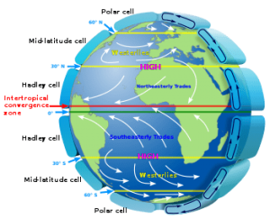
The global wind patterns are caught into six cells, two polar cells, two mid-latitude or Ferrel cells and two Hadley cells between the equatorial lows and subtropical highs.
The global wind patterns in the Hadley and Polar cells are due to the cold air in the high-pressure belts being pushed away/sucked towards the low-pressure belts, where the by now sun warmed air rises up to about 18km high and spreads underneath the tropopause away from the equator towards the 30th latitude (Hadley cells) or the poles(Polar cells) where the now cooled air again descends in the high-pressure belt just to travel towards the low-pressure belts.
The midlatitude or Ferrel cells arise due to the movement of the Hadley and Polar cells. The Ferrel cells are prone to stormy and rainy weather.
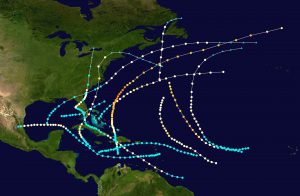
Atlantic Hurricane season
Hurricanes are rotating storms in the Atlantic as typhoons are in the pacific.
The water needs to be at least 29°C and high pressure/low wind shear above the hurricane. Most hurricanes begin to form across the equator.
The warm moist air rises upward from the ocean surface. The warm air rises, creating a low-pressure system.
All the surrounding areas with high pressure push into the low-pressure area. Then the new air becomes warm and moist and rises also. As the warm moist air rises and cools off, the water in the air forms clouds. This whole system of clouds and wind spins and grows, fed by the oceans heat and water evaporating from the surface. Trade winds will then blow air across the equator and help push the storm along.
The hurricane will rotate in a counter clockwise fashion in the North due to the ‘Coriolis effect’. The Earth’s rotation causes the ‘Coriolis effect’ and curves air in the Northern hemisphere to the right. The opposite happens in the Southern hemisphere.
The hurricane will continue to move across the ocean and pick up strength if the water temperature remains above 29°C or 79° Fahrenheit and high pressure remains above the storm and there is moisture to fuel the storm. Hurricanes are measured by windspeed and barometric pressure. The amount of windspeed needed for a storm to be classified as a hurricane is 119km/h or 74 mph and up.
As a general guideline September is the peak time for hurricanes because the ocean temperature is at its peak at this time.
Can you predict how the weather on Curacao will be in September?
Share this post


AWA SALU KITEBOARDING
St. Joris Baai Curaçao
Latest library items

Hoe het weer werkt
Het is weer zover… Het orkaan én regenseizoen hebben zich weer aangekondigd. Al een paar dagen is er geen zuchtje wind voelbaar en de nachten zijn voorzien van heerlijke regen [...]

Buying A Second Hand Kite
Buying a second hand kite can be a bit tricky unless you know exactly what you are looking for, so let's make that happen! Do you want a new [...]
Is Kiteboarding Dangerous?
If kiteboarding is dangerous? Well, the most important of all is that almost everybody can learn to ride. Women, men, young and old. Even if you are not the fittest [...]
The weather on Curacao
For the weather on Curacao are going at it again.. the hurricane- ánd rain seasons have announced themselves. For a couple of days already there isn’t a single breeze to [...]